Safer Streets for Westwego
A Safe Streets For All Plan is a strategic road map created by the City of Westwego to prevent all traffic-related deaths and severe injuries while promoting safe, healthy, and equitable transportation options.
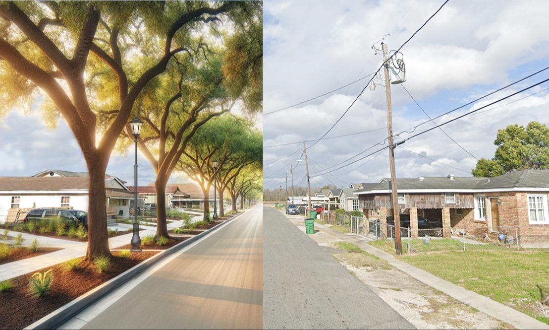
Central to this plan is the development of a multimodal transportation network that offers diverse mobility options for individuals of all ages and abilities. Enhancing the safety of our streets for pedestrians, cyclists, drivers, and public transportation users is crucial to fostering a stronger, more connected community.
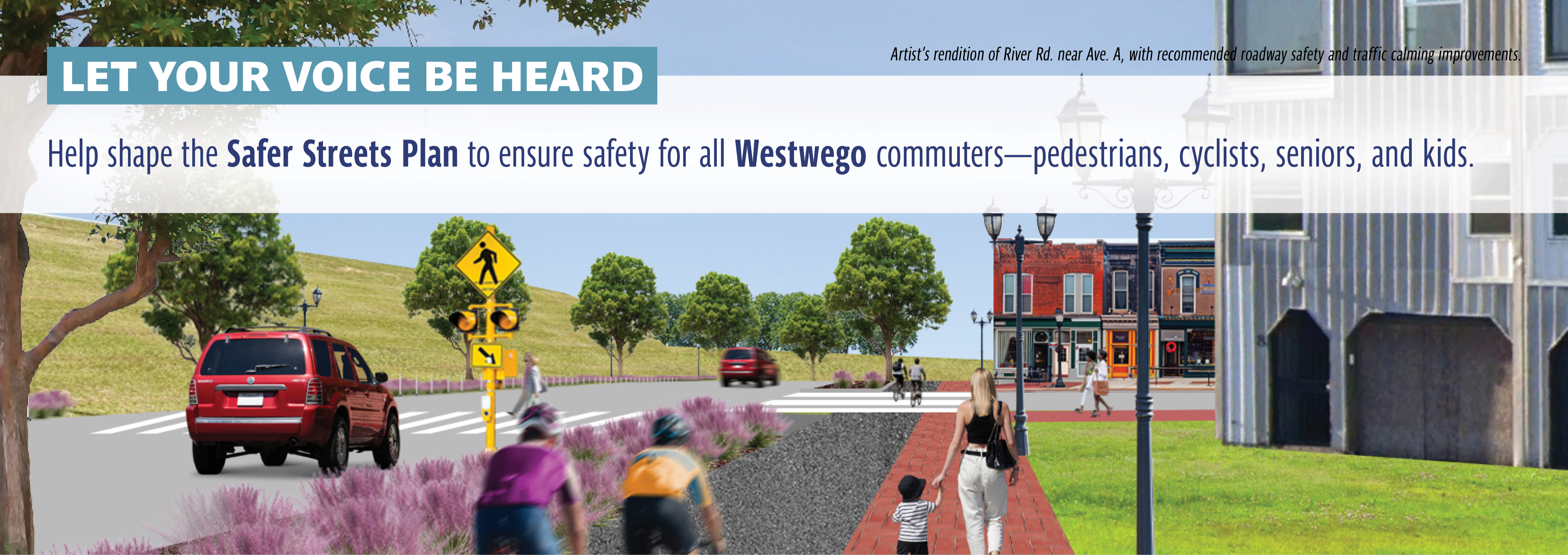
The plan is grounded in data and informed by input from public and stakeholder engagement, aiding with prioritizing streets and intersections for safety and connectivity. At this time, a focus is being given to River Road, Sala Avenue, 4th Street, and Keyhole Canal Greenway; as well as City-wide traffic safety measures such as stop signs, speed bumps, bike lanes, etc., as part of the City's Safer Streets plan.
This ambitious Plan underscores our commitment to ensuring the safety and well-being of all residents and visitors to our city.